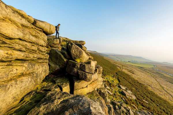
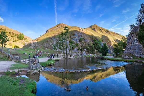
The Peak District is, as you might expect, pretty famous for its peaks, some of which tower over 2,000 ft above sea level. This isn’t the Alps, so you’re not going to need specialised climbing gear and oxygen tanks to get to the top – many have footpaths taking you to the summit. However, these peaks still offer a challenge to most hikers, rewarding your efforts with a beautiful view.
Different parts of the Peak District have different rocks, plants, wildlife and terrain. This means that each peak offers a different view. We’ve picked out the best of the bunch and, as you’ll see from the photos in our list, they’re all worth taking the time and effort to conquer.
- 1
Higher Shelf Stones
An amazing view and a morbid past

- 遊歷
- 經濟實惠
- 拍照
The Higher Shelf Stones is part of the Bleaklow area and shares the same rather bleak appearance, consisting mostly of peat-covered gritstone moorland. While fractionally shorter than Bleaklow Head (it only reaches 2,038 ft), it stands out for its more impressive position, offering an outstanding view across the valley. Of course, you need to have good weather to be able to see it.
The most striking feature of Higher Shelf Stones is the wreckage of a 1940s warplane nearby. A B-29 Superfortress, transferring to a new base in Cheshire in November 1948, crashed into Higher Shelf Stones due to bad weather. All 13 US servicemen on board were killed.
地圖 - 2
Shining Tor
The highest point in Cheshire

- 遊歷
- 經濟實惠
- 拍照
Shining Tor has been the highest point in Cheshire since 1974, when the previous highest point (Black Hill) was moved into a neighbouring county by moving the border. It’s the highest peak of long moorland ridge and offers a very nice view of the surrounding area on clear days. In fact, on a very clear day, you can see Manchester and even Snowdonia in North Wales.
There are several pleasant routes up to Shining Tor, the most popular of which goes from the Upper Goyt Valley, via Errwood Reservoir. If you fancy a gentler climb, you can start from the Cat and Fiddle Inn, which is the second-highest pub in England.
地圖 - 3
Back Tor
Enjoy outstanding views of Ladybower Reservoir

- 遊歷
- 經濟實惠
- 拍照
Back Tor is a gritstone escarpment that overlooks the Upper Derwent Valley in the Peak District. From the 1,765-ft peak and its unique rock formations, you can see down to Ladybower Reservoir – a very beautiful view.
The walk up to Back Tor is quite a popular one, in part because it’s fairly close to Sheffield. The area also offers some good rock-climbing sites, especially at the nearby Dovestone Tor. There are about 50 climbing routes here, ranging from difficult to extremely severe.
地圖 - 4
The Roaches
Watch out for the mermaid

- 遊歷
- 經濟實惠
- 拍照
The Roaches is a rocky ridge that reaches a height of 1,657 ft above Leek and Tittesworth Reservoir. You can see most of Cheshire from this location and you can even make out Snowdon in Wales on a clear day. Aside from the view, you can also enjoy rock climbing and freerunning here, which makes it a popular spot at weekends.
The Roaches is home to a few very interesting features. Doxey Pool is located by the path up to the peak and is supposed to contain a mermaid by the name of Jenny Greenteeth – be wary of her enticements into the 55-ft-long and 33-ft-wide pond. Look out for peregrine falcons in the area and, though the colony is thought to be extinct now, you might even find some Australian Bennett’s wallabies, which were first released here in the 1930s.
地圖 - 5
Win Hill
Earn an awesome view

- 遊歷
- 經濟實惠
- 拍照
Win Hill is a challenge to climb but rewards those who make it to its 1,519-ft-high peak with a great view of Ladybower Reservoir. The most challenging of the various routes to the rocky summit departs from Yorkshire Bridge and heads up the steep and slippery Parkin's Clough, which involves a 980-ft ascent in just ¾ mile.
At the very top of Win Hill is a little lump called Win Hill Pike, though it’s also known as the Pimple. Getting to this triangulation point is considered so challenging that it’s used as a Duke of Edinburgh Award station – a target on the programme designed to inspire self-improvement in young people.
地圖 - 6
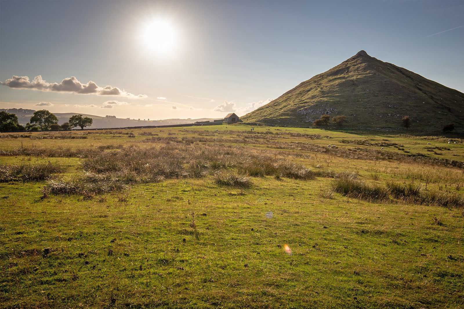
Thorpe Cloud
Come and watch the sun setting twice in a single day
- 遊歷
- 經濟實惠
- 拍照
Thorpe Cloud is not only an attractive climb, but it’s made even more interesting by the fact that much of the rock the peak is made of contains ancient fossils. The limestone hill was previously a coral reef, so there’s plenty of 350-million-year-old marine life you can easily spot.
Thorpe Cloud is on the eastern side of the River Dove and the beautiful countryside around it was used as a location for filming parts of 2010’s Robin Hood, starring Russell Crowe. Come up here around the summer solstice and you might be lucky enough to see a double sunset.
地圖 - 7
Alport Castles
A naturally formed motte and bailey castle

- 遊歷
- 經濟實惠
- 拍照
Alport Castles is a relatively unknown peak in the Peak District but it's well worth discovering. Thought to have been formed by the biggest landslide in UK history, the resultant pile of rocky debris looks a lot like the Norman motte and bailey design of castle – hence the name.
The Alport Castles dominate the eastern side of the River Alport Valley (hence the other part of its name) and offers a fantastic view. It’s also a popular place for birdwatchers, with ravens and peregrine falcon’s calling the craggy terrain home. The hike up to the peak starts from Fairholmes in the Derwent Valley and starts steep before levelling out.
地圖相片由 Mark Rickaby 提供 (CC BY 2.0) (經修改)
- 8
Higger Tor
Not planning to visit? Inconceivable!

- 遊歷
- 經濟實惠
- 拍照
Higger Tor is a striking attraction of the Dark Peak, standing at 1,424 ft in elevation. The erosion-shaped gritstone rocks here overlook the Burbage Valley and Carl Wark. Located within the city boundary of Sheffield, just around 8 miles southwest of the city centre, it's an easy spot to get to.
The whole area around Higger Tor, including the route up to the peak, is absolutely beautiful. However, be sure to take the time to explore Carl Wark. You'll find an Iron Age hill fort and some familiar scenery if you're a fan of the 1987 film The Princess Bride.
地圖 - 9
Kinder Scout
Don your walking boots and ascend the highest point in the Peak District

- 遊歷
- 經濟實惠
- 拍照
Kinder Scout is the highest point in the Peak District and no avid walker or explorer would want to miss out on the opportunity to reach its summit. The breathtaking landscape up here boasts rugged moorland, rocky terrain, babbling streams and even the mighty Kinder Downfall – the Peak District’s tallest waterfall.
Depending on your climbing ability, there are a number of different routes up Kinder Scout, from manageable paths that incorporate the famous Jacob’s Ladder steps, to tougher routes that require some scrambling. The best place to park for Kinder Scout is in the village of Edale, then it’s just a short walk to the foot from there.
位置: High Peak S33 7ZJ, UK
地圖 - 10
Mam Tor
Soak up the Peak District’s most iconic views

- 遊歷
- 經濟實惠
- 拍照
Mam Tor is the site of one of the most popular walks in the Peak District, effortlessly combining unforgettable views with easy walking routes, meaning people of all abilities can enjoy its beauty. The 1,696-ft hill is famous for its superb views from the top – some of the best in the country, let alone the Peak District. Many of the most iconic Peak District images are captured from up here, so be sure to have your camera with you.
The idyllic village of Castleton is a great base for starting circular routes around Mam Tor and the surrounding ridges. If you have time to explore further, the village is known for its mesmerising caverns, which are well worth a visit.
位置: Hope Valley S33 8WA, UK
地圖 - 11
Bleaklow Head
It may be bleak, but it isn’t low

- 遊歷
- 經濟實惠
- 拍照
Bleaklow Head certainly lives up to a part of its name, being covered in barren peaty moorland with very changeable weather. However, being only a few feet shorter than Kinder Scout, its ‘head’ is certainly not low. The area’s bleakness means that you should only really explore this area with a good map and good weather, but it’s worth doing.
There’s a triangulation point built on the peak in the 1930s to mark the 2,077-ft-high summit. From this point, the landscape is gently sloping, with a valley visible to the east.
地圖相片由 John Fielding 提供 (CC BY-SA 2.0) (經修改)
- 12
Black Hill
The highest point in West Yorkshire

- 遊歷
- 經濟實惠
- 拍照
Black Hill reaches a height of 1,909 ft, making it the highest point in West Yorkshire. It was previously the highest point of Cheshire, but the county boundaries were moved in 1974 and it switched from the western side of the Pennines to the eastern side. The small mount at the very top of the hill is known as Soldiers’ Lump because it was constructed by members of the Royal Engineers around 1748 as part of the original Ordnance Survey.
Black Hill straddles the spine of England, with the paved pathway of the Pennine Way passing right over the summit. This makes it comparatively easy to get to, though there are more challenging routes you can take to the top.
地圖

